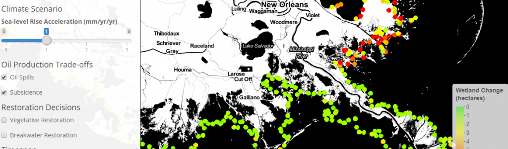
A tool developed to assess coastal wetland loss in the Northern Gulf of Mexico given various management, restoration, and/or land-use plans. The tool integrates biological, hydrological, and geographical data under multiple spatial scales into a holistic framework while considering uncertainty by using Bayesian inference. This framework can be used world-wide for similar assessments.